Columbia Plateau
The Columbia Plateau Trail certainly looks good on paper, and I’ve been wanting to investigate this route for a few years now. On paper the trail runs 130 remote Eastern Washington miles from Cheney (near Spokane) to Ice Harbor (near Pasco). In reality, only the eastern and western ends of the trail are “developed” with the middle section variously labeled “remote” and/or “inhospitable.”
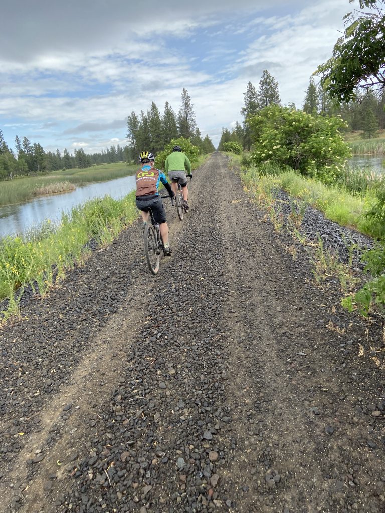
Bill, his friend Bill, and I met two miles outside of Cheney at the Fish Lake trailhead, and started east on a wonderful paved trail that passes through basalt railroad cuts and then along the shores of Fish Lake. Just shy of four miles into the route we hit the gravel. The first few miles were deep pea gravel, and riding through it was an experience none of us found enjoyable. The small unconsolidated rocks soon became big unconsolidated rocks.
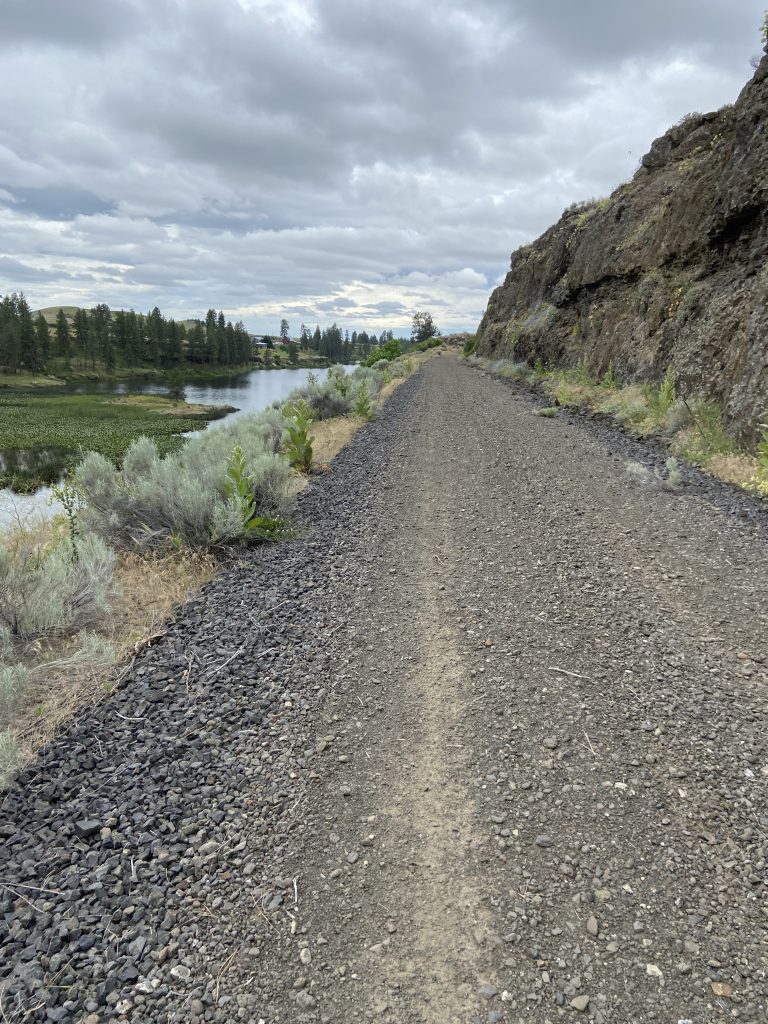
I said to Bill that perhaps the Parks Department ought to have a few “drive the trail” weekends to pack it down. Bill noted that this eastern Washington Basalt simply doesn’t pack down and sinter up like the crushed rock used on trails and roads in the western portion of the state. Either way the trail was rough going. We did have some headwind coming out of the west, but whatever effect it had on our speed was minimal compared to our difficulty negotiating the rough trail.
During my numerous trips across the state on Interstate 90 I’ve noticed a dramatic shift in the landscape between the towns of Sprague and Cheney. I would label the area near Sprague as “badlands” – rough, rocky, arid terrain, sparsely populated and inhospitable, whereas Cheney is surrounded by rolling green hills and coniferous trees – mostly Ponderosa Pine. As we rode west away from Cheney we left the trees behind and entered the badlands.
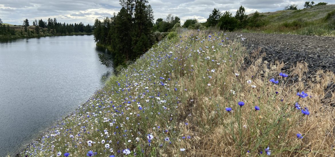
Rough country has a beauty, but I found it difficult to enjoy the passing scenery as I was too focused on picking my way through a minefield of baseball-sized sharp-edged rocks. We did pass several stretches of wildflowers, but I have to say that the negative of the rough trail surface far outweighed any scenery positives. At mile 20, with the weather deteriorating we decided to turn around and head back to the cars.
During the westbound leg all three of us agreed that we were climbing a long gradual hill, but now that we were heading east we seemed to be climbing the same hill. In actuality the trail is nearly pool table flat and the ruler straight trail appears to go uphill as it stretches to the horizon. Twenty miles later we were all happy to see the parking lot.
The Columbia Plateau Trail has a lot of potential, especially when combined with the John Wayne Pioneer Trail to the south, but right now it’s not ready for prime time. Riding the trail is nearly all work and no play. The trail works as an adventurous way to link up other routes, but as a stand alone route I don’t recommend it.