One thing I really like about gravel riding is the sense of community. Every Monday a new crop of opportunities emerge on Strava and the NW Gravel Riders Facebook page. Lines, loops, climbs, link ups, so much gravel so little time. One such line was a Strava route forwarded to me by my buddy Dan L: a 190 mile ride loop ridden by Zach Jones, a portion of which linked up the town of Greenwater on Highway 410 to Snoqualmie Pass on Interstate 90.
Much of my riding this summer has been near Snoqualmie Pass, and I’ve often wondered about the ability to link up I90 to Hwy 410. I knew that motorcyclists and 4×4 overlanders made the trip, but I’d never heard of a bicyclist doing it – until now.
Erik O, Dan L and myself met at Erik’s Snoqualmie Pass house, loaded the bikes into my truck and made the pot-holed drive up and over Stampede Pass to the abandoned town of Lester. Erik and I had ridden over Stampede Pass enough this year, so a little gasoline assist felt deserved.

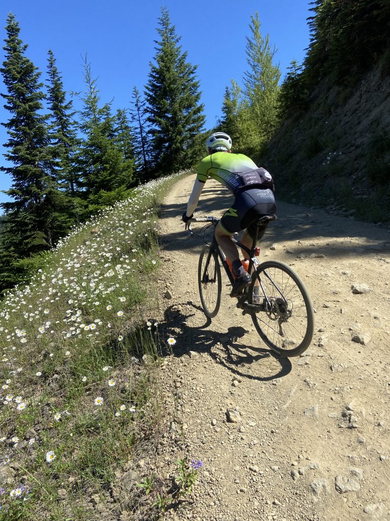
The climb starts immediately, but the first five miles are a gentle “I can do this all day” shaded uphill. We turned off of the Tacoma Pass route and the ascent got serious, my Garmin told me the news: 7 miles and 3300 feet of elevation. The grade never goes into single digits, but for the first mile or so the road surface was descent gravel and we each found our pace. Thankfully I had installed a 46-tooth rear cog. Dan is a superior climber, one of the best around, but he was feeling the pressure of a much smaller cog set.
The road surface quickly degraded until we were riding on top of what seemed like half-buried footballs. Thank goodness for my bailout gear as spinning was the only way to keep upright. Dan really had to mash on the pedals to simply to preserve some sort of forward motion. Out of the saddle was out of the question, and my back really started to feel the pounding.

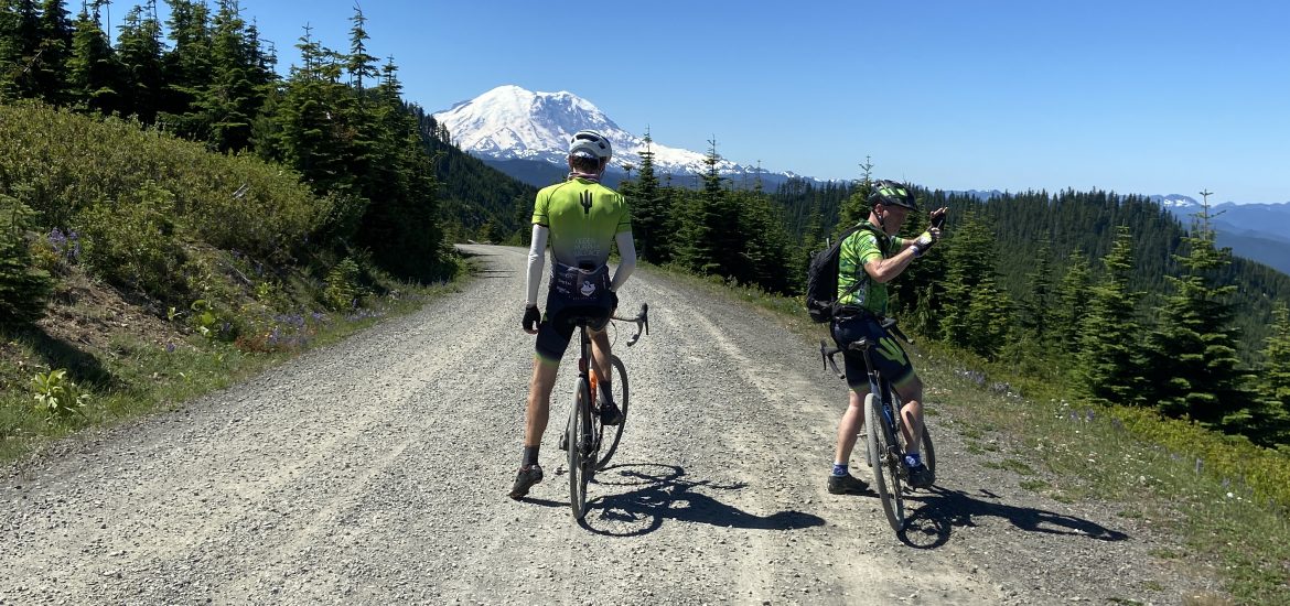
Finally, after long last, my Garmin noted that I had reached the top, but I hadn’t reached the top of anything, not even the false summit. And oh yes there is a false summit. Once we reached the top we were rewarded with views of Mount Rainier to the south and the Stewart Range to the North. I don’t think I’ve ever seen a view that stretches from Chair Peak to the west to Little Anapurna to the East. The view almost made the climb seem worth it, almost.
“I think going down is going to be worse that going up,” I said to Erik and Dan when I finally caught up with them at the top. “We might have to walk some of that.”

The descent down the other side is a standard issue gravel road, albeit with a lot of washboard. Descending towards Greenwater was like going into a shooting range. No correct that, it was going into a shooting range. We passed four groups of people doing target practice, all using large caliber guns. I grew up in the Midwest and this stuff doesn’t bother me, but I can see how it could be disconcerting.
We hit pavement, rode up a steep mile and then descended nine miles into the small town of Greenwater. We had to ride two miles on Highway 410 amid a constant stream of cars and trucks, many of which were hauling large trailers. After a morning of quiet personal introspection (why am I doing this) the hustle and bustle of Greenwater was rather startling.
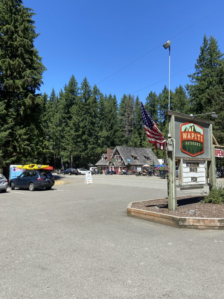
Greenwater is the last town before the Southeast entrance to Mt Rainier National Park, and I’m sure most of the traffic consisted of park goers. The parking lot of the Naches Tavern was filled with thirty to forty large bore motorcycles and the rumble of comings and goings was constant. Erik dipped into Wapti Outfitters for ice cream while Dan and I bought Coke, water and candy bars at the nearby convenience store. When we returned to the well-maintained grassy area in front of Wapiti Outfitters Erik exited the store carrying a pizza box. I can now say that it was those two slices of peperoni that got me back up over the pass and down to the car.
The return trip up to the pass was much more difficult than anticipated. What appeared on the descent to be reasonable grades turned out to be at least 14%, and at times 18%. Once again thank goodness for that 46. We didn’t get much in the way of shade on the climb and the sun, though much appreciated, was a bit hot. Thankfully, I’d filled up my third water bottle in Greenwater.
We had no celebration on the top as all three of us knew what lie ahead.
None of us went over the handlebars and we never had to walk, but we did have to stop several times simply to rest our hands and stretch our backs. My brakes were on 90% for the entire trip down, at no point were we coasting. I’m going to have to replace those pads this week.
We finally made it to the bottom of the rough stuff from where we were treated to five miles of hero gravel down to the car.
This was one of those rides that’s good to have done. We now know that the route goes through, and is ridable on a non-suspension gravel bike, but I don’t plan to go back any time soon.
Route information can be found at: https://www.strava.com/activities/3821793516
